Great North built a predictive tool that helps us prepare for natural disasters across Canada, from wildfire to flood, so that our emergency and essential aviation services are ready the moment they are needed.
Our job is to support the communities affected by a disaster, the first responding teams on the ground, and the systems and infrastructure behind them — work Great North has done for years, in proud cooperation with governments, emergency response organizations, and the local communities we serve. Supporting them well starts with knowing where we are likely to be needed, when, and for how long.
The tool turns a complex national picture into actionable operational intelligence for our planning teams, our operations personnel, and the wider business functions that support them.
It is built from, and relies on, the information the provinces and agencies produce. Everything we build sits downstream of that work. We gather what federal, provincial, and local agencies publish, along with information from the communities themselves, and feed it into a single portal that forms the nucleus of everything we have built on top.
From that foundation, we add several other sources and apply our own analysis to anticipate deployments in rapidly changing emergency environments. The dashboard then lets our team see, at a glance:
- Where activity is building across the country, and which situations are trending toward something more serious.
- An evacuation watch showing the communities reachable only by air that sit closest to the most serious events, ordered by urgency.
- An early signal drawn from satellite detection that surfaces new activity hours before it has a name or a size.
- A weather outlook that looks ahead and is refined in real time, so developing high-risk situations are predicted to the best of the tool's ability.
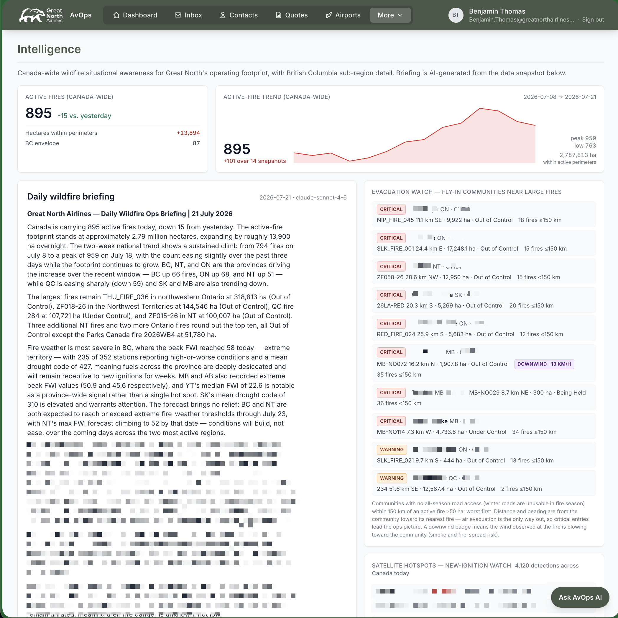
All of this lets us prepare the practical things well ahead of time — crew accommodation, maintenance support, crew transportation, and local travel requirements — in close cooperation and integration with the government agencies, humanitarian organizations, and local communities leading the response. It is how we keep resources in place rapidly and our aircraft ready to fly the moment we are called, with a forecast of how long the deployment will likely last.
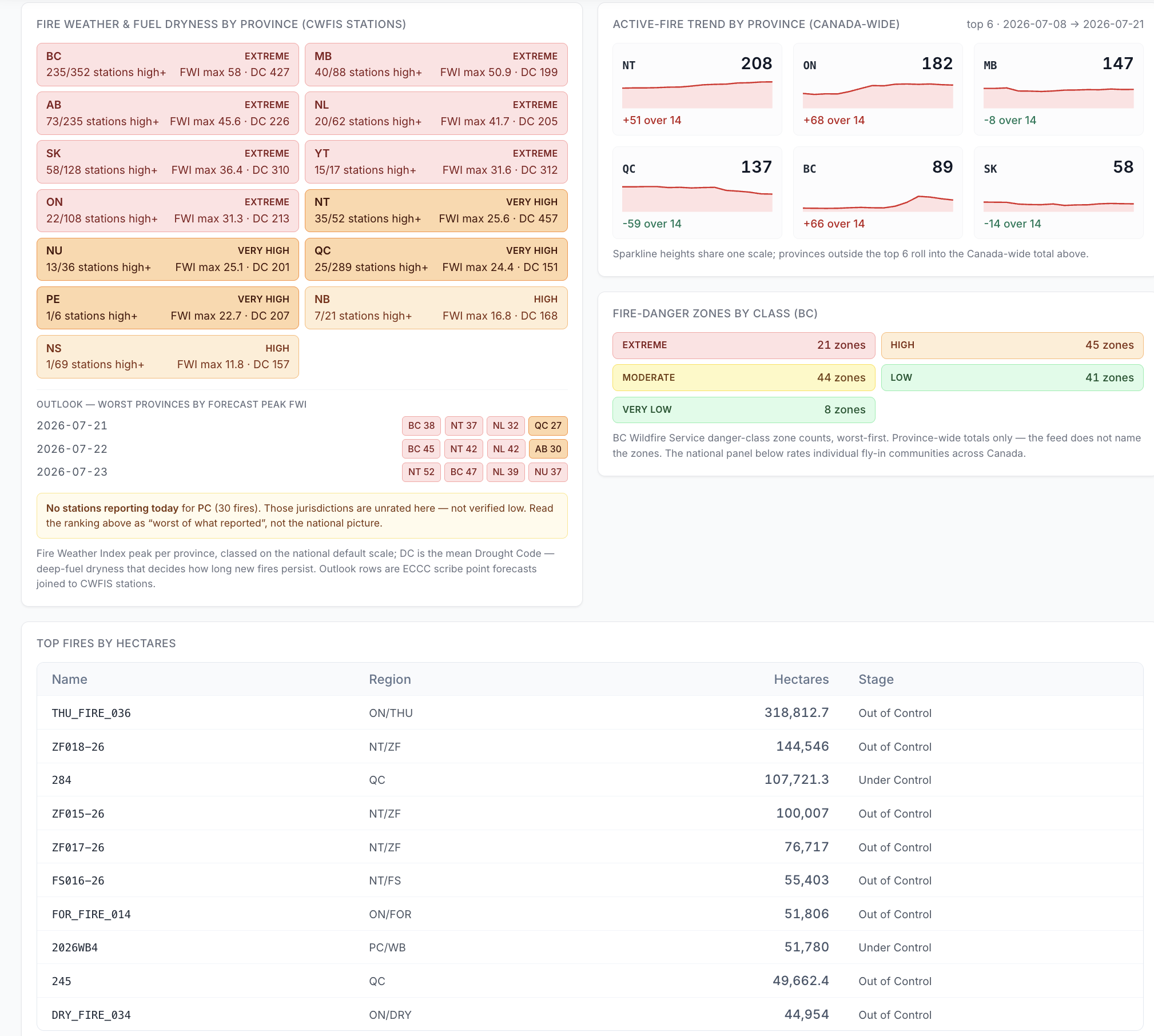
This time of year, the tool supports our wildfire essential and emergency response across the country. The tool is constantly being evolved to include other natural disasters as well, including flood response through the spring season, and when our aircraft travel to other parts of the world during Canada's quieter months, it is built to plug into other regions' information as well.
The community members, the firefighters, the emergency crews, and everyone on the front lines are the ones who matter most. Everything we do is in service of their work. Ours is a support role, and this tool helps us respond reliably, safely and with a predictable and well supported product.
Great North Airlines — greatnorthairlines.com